
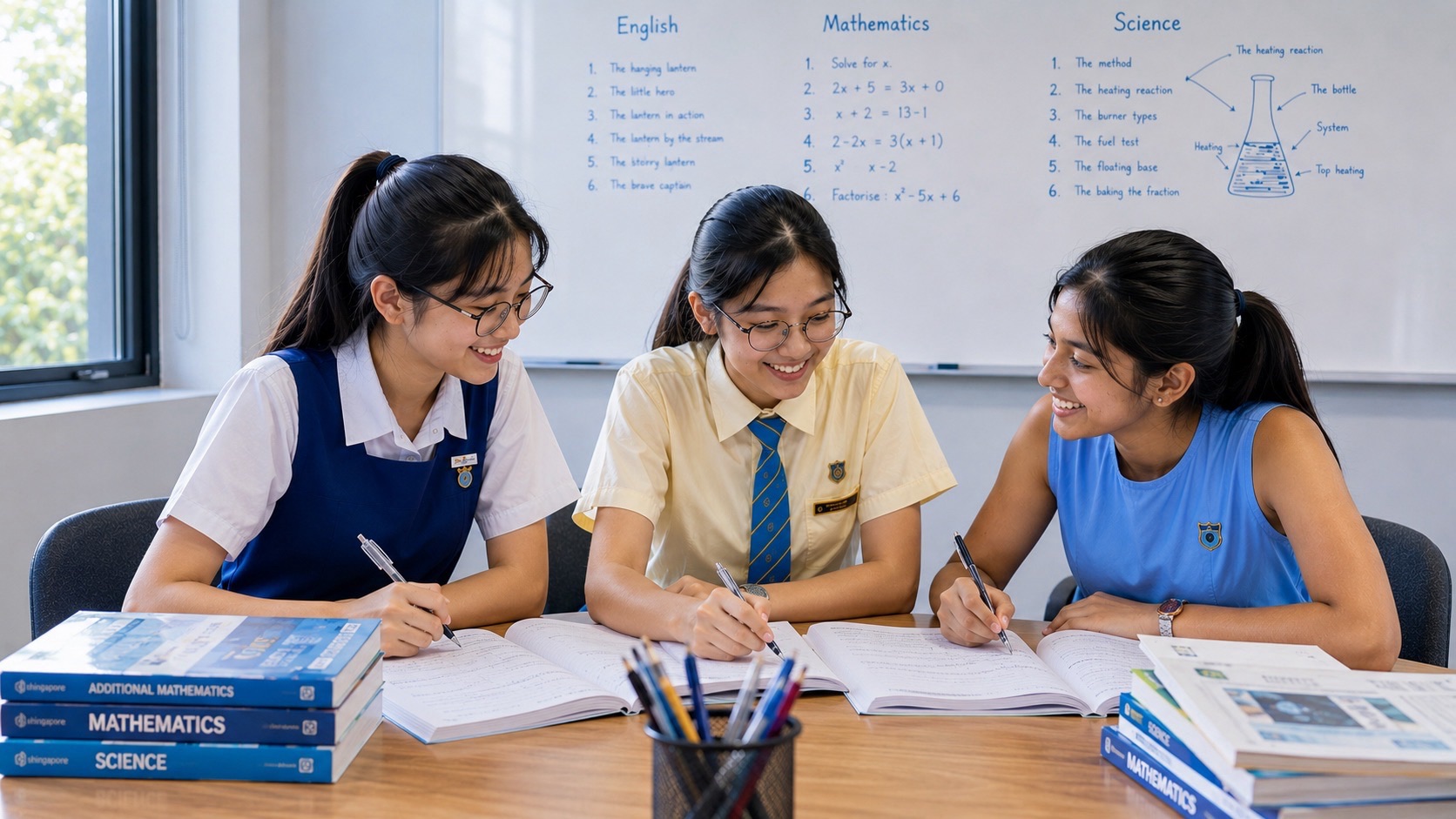
Secondary 1 G2 Geography introduces students to the relationships between people, places and environments. Children learn to ask where something happens, explain why it happens there, read geographical information and judge possible responses to environmental problems. G2 is the level of this subject under Full Subject-Based Banding; it does not describe a child’s ability in every subject or decide their future. For parents, the immediate priority is to understand the school’s Geography programme and help their child turn observations into clear, supported explanations.
The MOE lower-secondary Geography syllabus covers two years, while each school communicates its teaching sequence and assessment arrangements. Water, tropical rainforests and mangroves are central natural-resource topics; housing and transport belong to the wider lower-secondary programme. Secondary 1 Geography is school learning and assessment, not a national SEC examination taken in the first year. This guide explains the subject, offers original practice examples and shows parents how to discuss progress, support needs and later subject-level options with the school.
- What G2 means: a subject level within Full Subject-Based Banding, with room for later review of the student’s learning needs.
- What students practise: observation, geographical vocabulary, maps, graphs, explanation, investigation and reasoned conclusions.
- What to check with school: the current content outline, textbook, assessment scope, investigation instructions and feedback.
- How parents can help: use a short example, ask for evidence and repair one specific difficulty at a time.
- What comes later: discussion of Secondary 2 subject levels, upper-secondary choices and the relevant SEC syllabus nearer the examination year.
- Where to begin: read the curriculum explanation, try the short diagnostic and bring the resulting questions to the subject teacher.
eduKate Yishun · Secondary 1 G2 Geography
Find your next learning step
Choose the part that matches your question, or read the guide in order. The examples support discussion with your child and the school.
Understand the subject · Explore worked examples · Study and check · Try the diagnostic · Parent questions
Contents
Chapters 1–7
- What does G2 Geography mean for a Secondary 1 student?
- Read the curriculum at the right level of detail
- Learn to see a familiar place through geographical questions
- Understand water as movement, storage and use
- Explain a water-management strategy through its mechanism
- Connect forest features to the conditions they help address
- Read maps, tables and graphs before explaining them
Chapters 8–14
- Match the answer to the question's job
- Treat geographical investigation as evidence gathering
- Identify the actual difficulty before adding more work
- Build a home routine that stays small and purposeful
- Understand assessment and later subject-level discussions
- Try a short diagnostic, then check the reasoning
- Questions parents commonly need answered
Full Subject-Based Banding allows a student’s subject combination to reflect different strengths and learning needs. A child taking G2 Geography may have a different level for another subject. Parents should therefore read the individual subject information, instead of assuming that a Posting Group describes every lesson their child attends.
Orchid Park Secondary School’s explanation of Full Subject-Based Banding distinguishes Posting Groups, which support admission and initial subject placement, from the subject levels students take. It also identifies Geography, History and Literature in English as the lower-secondary Humanities offerings at G2 and G3. These subjects should not be confused with the common curriculum that includes Art, Music, Design and Technology, Food and Consumer Education, Physical Education and Character and Citizenship Education.
For a child meeting Geography as a separate subject, the unfamiliar part is often the kind of answer required. Naming a river is different from explaining how activities beside a river could affect its water. Recognising a forest in a photograph is different from describing a visible feature and explaining its function. The movement from recognition to explanation deserves explicit practice.
Begin with a manageable question: “What did you notice, and what makes you say that?” A child who points to a diagram but cannot explain it needs help putting a relationship into words. A child who explains confidently but misreads a graph needs practice with evidence. Those are different needs, and neither is usefully addressed by simply demanding more memorisation.
A useful first goal is independence with one small task. The child should be able to read a short question, identify the information needed, produce an answer and check whether that answer actually addresses the question. Speed can develop after those steps become dependable.
The MOE Lower Secondary Geography syllabus for G2 and G3 organises learning around sustainable resource use and management. Its four topic areas are water, tropical rainforests and mangroves, housing, and transport systems. It also introduces geographical concepts and investigation. The document identifies certain outcomes and content as optional for G2; a shared syllabus document does not mean that every line has the same status for both levels.
Use the national syllabus to understand the direction of learning, then use the school’s current outline for the child’s immediate work. Avoid turning a two-year document into a claim that every topic must be completed in Secondary 1. Equally, do not assume that a topic missing from this term’s worksheet has disappeared from the programme.
As a local example, Yishun Secondary School publishes Geography content outlines, including one for Secondary 1 G2/G3. Its published outline moves through introductory ideas, water, investigation, and tropical rainforests and mangroves. This illustrates how a school makes the curriculum concrete. It is not a timetable for every Yishun school, and parents should check the latest instructions issued to their own child.
Keep three items together: the current outline, the latest marked task and the next assessment notice. The outline tells you what the class is learning. The marked task reveals what the child can currently do. The notice identifies what needs preparation next. Reading these together is more useful than buying materials because their cover mentions the right school year.
When information appears inconsistent, ask a precise question: “Is this section required for our child’s G2 class, and will it be assessed in the next task?” That gives the teacher something concrete to answer.
Geography uses ideas such as space, place, environment and scale to organise thinking. A child does not need an impressive definition before using these ideas. A familiar walking route can provide an accessible starting point, provided the discussion stays focused on something observable.
Imagine a small neighbourhood park shown on a sketch map. A pond lies near one entrance, sheltered seats are beside another, and a playground occupies the centre. Asking where the features are and how far apart they lie directs attention to their arrangement in space. Asking why different people value the park directs attention to place and meaning.
Now consider the environment. The pond, soil and vegetation interact with paths, drains and other structures that people build or manage. A student can ask what happens to rain falling on different surfaces. The purpose is to connect features and processes, rather than divide the world into two lists that never meet.
Scale changes the question again. One puddle beside a path is a small observation. Flooding across a town concerns a much larger area. A photograph taken after one shower records a moment; a set of observations over several months covers a different time span. Evidence appropriate to the small question may be insufficient for the larger one.
Try asking, “What could this photograph tell us, and what could it not tell us?” A picture might show that the path was wet at that moment. It cannot establish that the path is wet every afternoon, identify every cause, or describe conditions throughout the neighbourhood. This distinction helps students make answers more accurate.
The same habit transfers to unfamiliar places in school materials. First identify the area and evidence supplied. Then decide the scale of the claim. A careful student can say something useful without claiming more than the source supports.
When revising water, separate three questions: where it is stored, how it moves and how people obtain usable supplies. This organisation makes a diagram easier to explain. It also prevents an answer about one process from being used indiscriminately for every water question.
Follow water through the physical processes as well as the storage diagram. Energy from the Sun supports evaporation: liquid water becomes water vapour. Plants also release water vapour through transpiration. When moist air cools sufficiently, water vapour condenses into droplets; droplets in clouds can grow and fall as precipitation. After rain reaches land, some water moves across the surface as runoff and some enters the ground. These are different pathways, not a requirement that every drop follow one identical route. PUB’s water-cycle learning resource provides a labelled local illustration. Ask the child to trace a possible route and name each process.
A simple original exercise uses a container representing a store of water. Suppose it starts with 80 units. During an imagined period, 30 units enter and 45 leave. The final amount is 65 units. The arithmetic is straightforward, but the geographical habit matters: identify the starting store, incoming flow and outgoing flow before describing the result.
Now change the exercise. If 30 units still enter but 70 leave, the store falls to 40. The student can explain that a continuing input does not guarantee a growing store. This helps challenge the loose claim that a renewable resource must always be available wherever people want it.
When looking at a water-cycle diagram, ask the child to follow one arrow at a time. What moves? Between which parts? What process does the arrow represent? Then cover the labels and ask for a short explanation. A correct sequence with ordinary words is a useful foundation for introducing precise vocabulary.
Singapore also provides a clear example of the difference between rainfall and managed supply. PUB explains local catchment water through the collection of rainwater in drains, canals and rivers leading to reservoirs, followed by treatment. PUB also distinguishes this from the separate system collecting used water. Students should not treat these collection systems as interchangeable.
A parent can ask, “Why does water visible in a drain not mean that someone should drink it?” The answer should distinguish collection from treatment and suitability for use. Keep such discussions observational: classroom investigation follows the school’s instructions, and looking at a waterway never requires entering it or handling its water.
“Save water” expresses a worthwhile intention but does not explain a strategy. A geographical answer needs to show what changes and why that change helps. Suppose a fictional school replaces leaking taps. Repairing the leaks reduces water lost when nobody is using the taps, so less water is needed to provide the same intended service.
Compare this with a fictional reminder campaign. Posters may encourage users to close taps fully, but their effect depends on behaviour. The first measure addresses a physical defect; the second tries to influence decisions. Both might help, yet they operate through different mechanisms and have different limitations.
A child can develop a balanced answer by asking four questions: What problem is being addressed? How does the measure work? What evidence would show whether it helped? What could limit its effect? These are practice prompts, not a compulsory examination formula.
For example, a student might propose comparing water use before and after repairs. The answer becomes stronger if it considers whether the number of users changed. A lower total during a school holiday would not, by itself, demonstrate that a new poster campaign succeeded.
At national level, the National Climate Change Secretariat describes Singapore’s Four National Taps: local catchment water, imported water, NEWater and desalinated water. It identifies NEWater and desalination as sources that do not depend on rainfall. This provides an official example of why a combination of sources matters when rainfall conditions change.
Parents do not need to turn this into a contest to memorise the largest number of statistics. Ask the child to explain one relationship accurately. Then add a second strategy and compare their roles. If current figures are required for a school task, use the dated official source or material specified by the teacher.
A tropical forest also has structure above ground. NParks describes Singapore’s lowland primary forests as having tall trees forming an upper layer, smaller trees beneath, and young trees and shrubs in the understorey. On a profile drawing, identify these levels before discussing how conditions differ between them. A photograph of the forest floor cannot by itself show the full vertical structure. NParks also distinguishes primary forests from secondary forests growing on previously cleared land. This helps a student avoid treating every patch of trees as the same habitat. Compare the actual features and history supplied by the source.
Students often recognise a mangrove photograph because roots are visible above the ground. The next step is to avoid treating every root shape as the same adaptation. A good explanation connects a particular feature with a particular condition and function.
NParks describes several mangrove root forms, including pencil, knee, buttress and stilt roots. Some assist gas exchange in waterlogged conditions; others help support trees in soft ground. This gives students a reason to inspect the actual feature in a photograph rather than supply a memorised answer about roots generally.
Consider an original classroom prompt: “A diagram shows upright roots projecting above muddy ground. Explain how this could help the plant.” A suitable response identifies access to air above the waterlogged soil and connects it with the root’s function. “It helps the tree survive” is too broad because it leaves the mechanism unexplained.
A different prompt might show spreading supports around the base of a tree. The child should reconsider which function fits that visible feature. Do not award an answer simply because it contains the word “adaptation”. The relationship between evidence and explanation is what needs checking.
NParks also explains that mangrove species use different adaptations to cope with coastal conditions. That qualification matters: one species’ feature should not become a claim about every mangrove tree.
For conservation questions, build a chain from an action to a consequence. In a hypothetical example, clearing vegetation removes habitat used by living things; a student can then discuss a possible ecological consequence. A separate question about people’s livelihoods may require another chain. Combining all effects into “bad for the environment” hides the understanding the child is trying to demonstrate.
Make comparison precise: name one similarity, name one difference, and state what evidence supports each. This is more useful than producing two disconnected descriptions and expecting the reader to infer the comparison.
An interpretation can only be as sound as its reading of the information. Before answering, identify the title, place, time period, legend and units. This short pause can prevent a correct geographical idea from being attached to the wrong measurement.
Use this invented rainfall dataset for practice: Site A records 40, 60 and 80 millimetres over three months; Site B records 70, 50 and 30 millimetres over the same months. Both sites’ values change, but they change in different directions. Site A rises by 40 millimetres from the first month to the third; Site B falls by 40 millimetres.
A weak description says that one site “has more rain”. A better comparison specifies when: Site B has more in the first month, while Site A has more in the second and third. It uses values to support the comparison and includes the unit.
The dataset does not explain the cause of either pattern. Students should not invent a cause merely because the question includes a graph. If an explanation is requested, they must use relevant learned ideas and any additional information supplied, making a reasonable suggestion where the task requires one.
For maps, practise a similarly disciplined sequence. Find the relevant symbols, locate the features and check the scale before estimating distance. On an imagined map where one centimetre represents 200 metres, a three-centimetre straight line represents 600 metres. That does not establish the walking distance if the actual route bends around buildings.
Distinguish a mapped observation from a conclusion. “The houses shown cluster beside the road” describes a pattern. “Road access influenced that distribution” suggests an explanation that may need further evidence. The student can learn both moves while keeping them separate.
Parents can help by asking the child to point to the exact number, symbol or feature behind a sentence. If there is nothing to point to, check whether the sentence is an inference and whether the inference is justified.
Questions asking students to describe, explain, compare or evaluate are asking for different work. Teach these differences through examples, then follow the teacher’s guidance about the particular task. A universal paragraph template cannot replace attention to what the question actually asks.
Describe: report the relevant characteristics or pattern. In the invented rainfall example, a description could state that Site A’s rainfall increases across the three months. Adding its first and last values supports that statement. A detailed account of water treatment would not answer this description question.
Explain: connect a cause or process with an outcome. For a fictional leaking pipe, the answer might explain that water escapes before reaching its intended users, increasing the amount that must enter the system to meet the same demand. The connection is explicit.
Compare: put two items on a common basis. Compare rainfall in the same month, or compare two management measures against the same objective. A paragraph about each item can still fail to compare them if it never identifies a meaningful similarity or difference.
Evaluate: consider how well an approach works in the circumstances. For the fictional school tap campaign, a student might discuss its potential to change habits alongside the problem of unrepaired leaks. A conclusion can say when the measure would help and why another action may also be needed.
To improve an answer, first underline the part that answers the question directly. Next identify its evidence or mechanism. Finally remove sentences that answer a different question. This is often more useful than adding length.
When a marked answer loses credit, ask whether the difficulty was knowledge, interpretation, explanation or task selection. Copying a model answer might produce a neat correction without repairing any of these. Have the child explain the correction and then attempt a new, similar question with different details.
A geographical investigation begins with a question that can be explored using appropriate evidence. It should not begin with a conclusion the group feels obliged to prove. The school’s task instructions determine the actual investigation; the following is an original practice example for understanding the reasoning.
Imagine students asking whether an illustrated school courtyard offers the same amount of shade at two observation times. A plan would identify the locations to observe, the times, what counts as shade and how findings will be recorded. Using the same locations makes comparisons more meaningful than moving to whichever spot looks most interesting.
Suppose the group records four locations once in the morning and once in the afternoon. Its evidence can describe those locations at those times. It cannot automatically establish conditions throughout the year. Cloud cover, the date and the limited observation points may affect what the results mean.
This is a useful way to teach limitations. A limitation is not a confession that the work is worthless. It defines the boundary of the conclusion. An improvement should address that boundary: repeated observations at relevant times may help with time coverage; adding appropriately selected locations may help with spatial coverage.
The MOE CPDD Geography Unit’s lower-secondary fieldwork examples similarly discuss how sampling locations and timing affect what water-quality observations represent. Their practical message is valuable: information collected at selected points should not be treated as a complete picture of an entire water body.
At home, a parent can ask the child to distinguish raw observations, a pattern in the observations and the conclusion. If all three are written as the same sentence, the investigation needs clearer reasoning. Help the child understand the instructions and organise materials, while leaving the observations, analysis and submitted work to the student.
“Weak in Geography” is too broad to guide support. Look instead at one recent task. Did the child misunderstand the vocabulary, misread the source, omit the causal connection, choose the wrong example or answer a different question? Each difficulty suggests a different next step.
For vocabulary, connect a term to a small example and a non-example. A child learning “distribution” could describe where trees appear on a sketch. Then explain why simply naming the tree species does not describe their distribution. Using the term correctly matters more than reciting its definition without context.
For missing explanations, ask the child to add the middle step. “The tap leaks, so water is wasted” can become a more precise account of water escaping without performing its intended use. The aim is a visible relationship, not an extra sentence inserted merely to make the paragraph longer.
For graph errors, return to units and reference points. If the child writes “increased by 80” when the final value is 80 and the starting value is 40, practise distinguishing final value from change. This is a reading and calculation issue that can be addressed directly.
For rushed answers, compare what the question requested with what the student wrote. Use one short question under calm conditions before adding time pressure. A child who cannot yet explain the relationship without a timer is unlikely to benefit from being asked to do it faster.
After practising, choose a fresh example. Improvement is more convincing when the student handles a changed situation, not only when they reproduce the correction beside the original question. Share persistent patterns with the teacher, together with a sample of the child’s work.
A practical home routine should fit around school assignments and the rest of the child’s week. The following is an adjustable example, not a prescribed study dose. Its purpose is to help parents see how revision can focus on understanding rather than simply occupying more time.
At the first short session, select one concept from the current lesson. Ask the child to explain it in ordinary language and give an example. Check the explanation against the textbook or teacher’s notes, then correct one important misunderstanding. Avoid trying to revise the entire chapter in the same conversation.
At the next session, use one source such as a diagram, table or photograph. Ask for two observations and one supported explanation. If the explanation goes beyond the source, discuss what additional knowledge or evidence would justify it. The distinction is part of the learning.
At a later session, revisit a marked response. Have the child explain the teacher’s feedback, improve the answer and attempt one different question. Keep a brief note of the difficulty addressed: “included units”, “compared the same month” or “explained how the strategy reduces loss”.
The note should describe a skill, not become a record of blame. If the child remains stuck, reduce the task. Work with a simpler source, read a difficult sentence together or ask the teacher which prerequisite idea needs attention. More questions are not automatically better when the same misunderstanding appears in every response.
Everyday discussion can stay light. A route map, a public information graphic or an illustration in a library book can prompt one useful question. There is no need to make every family outing an assessment. Preserve room for the child to notice things and ask questions that have not already been planned.
For the next school assessment, rely on the current notice and teacher’s instructions. Confirm the topics, source types, task format and materials allowed. An upper-secondary examination syllabus cannot tell a parent the exact scope or weighting of a Secondary 1 school task.
Look at feedback alongside the mark. A score summarises one performance; the marked script can identify a repairable problem. A child may know the topic but lose clarity when explaining. Another may write well but misunderstand the underlying process. These children need different forms of practice even if their totals match.
MOE’s Full SBB arrangements allow eligible students to take Humanities at a more demanding level from Secondary 2, based on aptitude and interest demonstrated in Secondary 1. Orchid Park’s official guidance explains this progression. Discuss readiness, support and the whole subject workload with the school; do not treat one practice result as a guarantee of a level change.
Ask the teacher what evidence would make the decision clearer. Is the student applying ideas independently? Can they interpret unfamiliar sources? Do they understand the demands of the next level? What bridging or continued support might be available? The conversation should identify the next learning step as well as the administrative choice.
Later, national examinations follow the Singapore-Cambridge Secondary Education Certificate framework, introduced from 2027. SEAB’s 2027 G2 list includes Geography and Humanities options involving Geography. These are later examination offerings, not names for a national Secondary 1 test. Use the applicable examination-year syllabus when that decision becomes relevant.
This original practice set is intended to reveal what to work on. It is not an official assessment, and its result should not be used to decide a subject level. Let the child explain aloud where useful, then compare the reasoning with the guidance below.
- Reading change: An imagined water store contains 90 units at the start. Twenty units enter and 35 leave. How much remains?
- Comparing data: Site X records 30 millimetres of rain in June and 50 in July. Site Y records 45 in June and 40 in July. Compare the sites in July.
- Using evidence: A photograph shows litter beside a stream. Does it prove that the stream is polluted at every point?
- Explaining a measure: How could repairing a leaking pipe reduce the amount of water needed to provide the same service?
- Recognising a limitation: A group observes one courtyard location on one afternoon. Can it conclude that every part of the courtyard has the same conditions all year?
- Improving a question: Replace “Is this place good?” with a clearer geographical question that could be investigated using a supplied map or observations.
Answer guidance: For question 1, 75 units remain: 90 plus 20 minus 35. If the answer is 145, check whether the child treated the outgoing flow as an input. For question 2, Site X records 10 millimetres more than Site Y in July. Both the comparison and its unit matter.
For question 3, the photograph provides evidence of litter at the visible location and time. It does not establish water quality throughout the stream. Further investigation would be required. For question 4, repair reduces water escaping without providing the intended service, so less input may be needed to supply that service.
For question 5, the evidence covers one location and occasion. Broader conclusions require suitable additional observations. For question 6, one possible question is, “How far are the marked seating areas from the two entrances?” Another could investigate which observed locations have shade at a stated time. A good question identifies something specific enough to examine.
Choose the next step from the pattern of responses. Calculation errors call for attention to quantities. Unsupported conclusions call for discussion of evidence. Vague explanations call for a clearer mechanism. If several difficulties appear, begin with one and bring examples to the teacher rather than interpreting this short exercise as a verdict on the child.
Is Secondary 1 G2 Geography mainly memorising facts?
Facts and vocabulary provide material for thinking, but students also need to interpret information and explain relationships. Check whether the child can use a learned idea in a changed example. Accurate recall is useful when it supports the task being asked.
Do we need the upper-secondary SEC syllabus immediately?
It can show a later destination, but the current school outline is more useful for organising Secondary 1 work. Avoid preparing the child for an examination-year specification that may not be the one they eventually sit. Keep the distinction between present learning and future options clear.
Should my child study every G3 topic to do well in G2?
First secure the requirements of the child’s actual class. The combined MOE document identifies differences in the status of some content. Ask the teacher which extension work would help this student. Additional material should have a clear learning purpose and fit the student’s overall workload.
What if my child understands verbally but writes weak answers?
Start with the explanation they can say. Help them identify its main claim, relevant evidence and causal connection, then write those ideas clearly. Compare the written version with the question. If the child cannot explain the idea aloud either, address understanding before polishing sentences.
What should we bring to a teacher conversation?
Bring one or two marked responses, the current topic information and a specific question. For example: “My child describes the pattern correctly but struggles to explain it. Which part should we practise next?” This gives the discussion a practical starting point.
What is a sensible action for this week?
Find the latest school outline, select one recent answer and identify one skill to improve. Practise that skill with a different example, then check whether the child can explain the improvement. A clear, manageable next step helps the family support learning while allowing the student to take increasing ownership of it.
Official sources and scope
Sources checked on 15 November 2026. This independent guide uses original teaching examples and invented practice data. Check the latest school instructions for the child’s class and the relevant examination-year syllabus for later SEC decisions.
- MOE Lower Secondary Geography Syllabus, G2 and G3
- Orchid Park Secondary School: Full Subject Based Banding
- Yishun Secondary School Humanities content outlines
- PUB: Water from Local Catchment
- National Climate Change Secretariat: Water Resource Management
- NParks BiodiversitySG: Mangrove forests in Singapore
- NParks: Recognising Trees of the Mangroves
- MOE CPDD Geography Unit: Lower Secondary fieldwork resources
- SEAB: Secondary Education Certificate
- SEAB: 2027 SEC G2 syllabuses for school candidates
- PUB: water-cycle learning illustration
- NParks: Terrestrial and freshwater ecosystems
Leave a Reply